No se han encontrado productos.
Introduction to GPS Topo Maps: Navigating the Basics
Topographic maps, commonly known as topo maps, have long been a tool for adventurers, hikers, and anyone venturing into the great outdoors. With the advent of GPS technology, accessing these maps has become easier and more efficient than ever before. GPS topo maps not only provide detailed geographical information but also enhance navigation by pinpointing your exact location on the terrain. Understanding the basics of how these advanced maps work is the first step toward leveraging their full potential for your outdoor adventures.
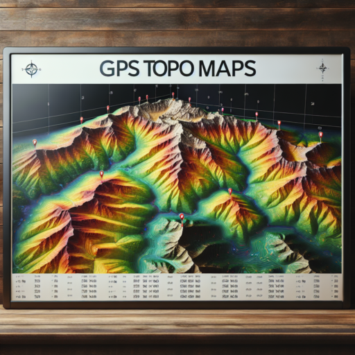
GPS topo maps integrate traditional topographic map features—such as contour lines, elevation data, and landmarks—with digital GPS technology, offering a dynamic way to view and interact with geographical information. This integration allows users to visualize the terrain in unparalleled detail, from vast ridge lines to minute elevation changes, directly on their GPS devices or smartphone apps. This detailed representation is invaluable for planning routes, anticipating challenges, and ensuring safety in unfamiliar or challenging landscapes.
One of the key aspects of navigating with GPS topo maps is understanding how to read contour lines. These lines represent the 3D shape of the terrain on a 2D map, with each line denoting a specific elevation. By learning to interpret these lines, users can discern the slope, aspect, and elevation gain of any given area, which is critical for making informed decisions in the wilderness. Additionally, modern GPS topo maps often include features such as waypoints, track logging, and route planning, further enhancing their utility for outdoor navigation.
The Best GPS Topo Maps for Hikers and Outdoor Enthusiasts
Exploring the great outdoors requires not just a zest for adventure but also the right set of tools to navigate the unknown with confidence. The Best GPS Topo Maps for Hikers and Outdoor Enthusiasts are designed to provide detailed geographical information, ensuring that hikers, campers, and nature enthusiasts can explore trails, identify landmarks, and find their bearings in even the most remote locations. These maps offer invaluable insights into the terrain, including elevation contours, topographical features, and points of interest, which assist in planning and executing outdoor excursions safely and enjoyably.
One of the key advantages of using topographical maps is their precision in displaying the lay of the land. For those passionate about venturing into the wild, understanding the intricacies of elevation changes, water bodies, and natural obstacles is crucial. GPS topo maps enhance this experience by incorporating real-time location tracking, making it easier to follow a set path or navigate back to a campsite. With advancements in technology, these maps are now incredibly user-friendly, available on multiple devices, and often come with features such as offline access, which is a boon in areas with limited cellular coverage.
Essential Features of GPS Topo Maps
- Comprehensive Trail Data: Detailed trails with marked waypoints to highlight significant landmarks or intersections.
- Offline Accessibility: Capability to download maps for use in areas without cell service, ensuring you stay on track no matter where your adventure takes you.
- Real-Time Location Tracking: Keep an eye on your exact location within the wilderness, improving your navigation and safety.
When choosing the best GPS topo map for your next outdoor adventure, it’s essential to consider the coverage area, the level of detail provided, the ease of use, and compatibility with your devices. Whether you’re a seasoned hiker trekking through familiar territory or an outdoor enthusiast exploring new landscapes, having a reliable GPS topo map at your disposal can significantly enhance your experience, providing peace of mind and a deeper connection with the natural world.
How to Use GPS Topo Maps for Efficient Navigation
Understanding how to use GPS topo maps effectively can transform your outdoor navigation experience, whether you’re hiking, mountain biking, or embarking on any adventure that draws you into the wilderness. These maps are not only a tool for identifying your current location but also a wealth of information that, when utilized properly, can greatly enhance your efficiency in navigation. Let’s dive into the essentials of making the most out of GPS topo maps.
Firstly, familiarize yourself with the basics of topographic maps. GPS topo maps display contours and geographic features in detail, providing a 3-dimensional representation on a 2-dimensional screen. The key to efficient navigation lies in understanding these contour lines and symbols, which represent hills, valleys, water bodies, and other terrain features. Utilizing this information allows you to plan your route more effectively, avoiding obstacles and shortening travel time by selecting paths that match your physical capability and environmental conditions.
Interpreting Contour Lines for Route Planning
One of the most critical skills in using GPS topo maps is learning how to read and interpret contour lines. These lines indicate elevation and the steepness of terrain. Closely spaced lines represent steep areas, while wider spaces signify flatter terrain. By reading contour lines, you can anticipate the difficulty of the terrain ahead and choose a route that best suits your needs. This is particularly important for avoiding unnecessarily challenging paths and for safety considerations in outdoor navigation.
Additionally, modern GPS topo maps often incorporate interactive features that can further aid in planning and navigation. Features like «pin drop» allows you to mark points of interest or waypoints, while routing functions can automatically suggest the most efficient paths between two points. Embracing these technologies can significantly cut down on preparation time and enhance the accuracy of your route planning, making your navigation experience smoother and more enjoyable.
Comparing GPS Topo Maps: Features and Functionality
When exploring the vast landscape of GPS Topo Maps, it’s crucial to delve into the various features and functionalities that distinguish the offerings in the market. These maps, designed to guide users through terrain with precision, vary significantly in detail, usability, and technological integration. Highlighting the most sought-after features can aid in making an informed decision tailored to your outdoor needs.
Detail and Accuracy
One of the paramount considerations in comparing GPS topo maps is the level of detail and accuracy they provide. High-resolution maps with up-to-date terrain information can be the difference between a successful expedition and a challenging ordeal. These maps often include contours, elevation data, and landmarks which are essential for route planning and navigation.
Usability and Interface
Equally important is the usability and interface of these digital maps. Users should look for maps that offer intuitive navigation and easy-to-read displays, especially in challenging environments. Features such as customizable waypoints, clear marking of trails, and offline access are essential for a seamless outdoor experience.
In summary, comparing GPS topo maps on features like detail, accuracy, and usability can significantly enhance your adventures. The right map can transform your outdoor experiences, providing not just a tool, but a companion guiding you through every step, slope, and summit.
Integrating GPS Topo Maps with Your Devices: A Step-by-Step Guide
Integrating GPS topographical (topo) maps with your devices enhances your outdoor experiences, whether you’re hiking, mountain biking, or planning a backcountry trip. This process can seem daunting at first, but with the right guidance, you’ll find it straightforward and rewarding.
Choosing the Right GPS Topo Maps
Before diving into integration, it’s crucial to select the appropriate maps for your needs. Various online platforms offer free and premium GPS topo maps tailored for different activities. Look for maps that offer high resolution, up-to-date trail information, and compatibility with your device. Prioritizing maps that provide offline access is also wise, ensuring you have the necessary navigation tools even in remote locations without cellular service.
Downloading and Installing Maps
After selecting your maps, the next step is downloading them to your computer. Many services offer downloadable files in common formats like GPX or KML, which are widely supported by GPS devices and smartphone apps. Once downloaded, the installation process varies depending on your device. For dedicated GPS units, you might need to connect the device to your computer and transfer the files directly. Smartphone users can often install maps through an app, streamlining the process.
Syncing Maps Across Devices
To ensure a seamless outdoor experience, syncing your topo maps across all your devices is beneficial. This synchronization allows you to plan your routes on a larger screen, like a computer or tablet, and then access those routes on the go through your smartphone or GPS device. Tools and platforms like cloud services can be instrumental for this purpose, automatically updating any changes across your devices. Remember to check for compatibility and any necessary software or app updates to make this process as smooth as possible.
Top 5 Free GPS Topo Maps and How They Fare Against Paid Versions
In the world of outdoor adventures, having a reliable map is as crucial as having a compass. The digital age has blessed us with GPS topo maps, offering detailed geographical information at our fingertips. Exploring the wilderness has never been easier, thanks to the wide array of both free and paid GPS topo maps available. This brings up an interesting comparison: how do the top free GPS topo maps stack up against their paid counterparts?
Access and Usability
One significant advantage of free GPS topo maps is, undoubtedly, their cost-free nature, making outdoor adventures more accessible to a broader audience. Sites like OpenStreetMap and apps like ViewRanger provide excellent topo maps without the need for subscription fees. However, it’s important to note that while the initial access is free, some features within these apps might require in-app purchases to unlock full functionalities. In contrast, paid versions such as Garmin’s BaseCamp offer comprehensive details and functionalities right from the start, designed for serious adventurers who need extensive and reliable data.
Quality of Data
The detail and accuracy of the map data are where paid GPS topo maps frequently outshine their free counterparts. Free maps like those from OpenTopoMap are often community-sourced, which means they can be very up-to-date with user-contributed trails and points of interest. However, this can also lead to inconsistencies and varying levels of detail. Paid maps, on the other hand, typically come from professional surveys, offering a uniform level of detail and reliability, critical for navigating challenging terrains.
Offline Functionality
A crucial feature for outdoor enthusiasts is the ability to access maps offline. Most free GPS topo maps allow users to download maps for offline use, but the size and detail of the downloadable area can be limited compared to paid versions. GAIA GPS, for instance, offers extensive offline capabilities for paid subscribers, including high-resolution satellite imagery. This is particularly valuable in remote areas where internet service is non-existent, ensuring that you have the most detailed and up-to-date information at all times.
Expert Tips for Reading and Interpreting GPS Topo Maps
Understanding GPS topo maps is essential for outdoor enthusiasts, hikers, and anyone engaging in activities where navigation is crucial. These maps not only provide detailed geographical information but also offer insight into the terrain’s elevation. With the right knowledge, interpreting these maps can significantly enhance your outdoor adventures. Here, we delve into expert tips that will help you master the art of reading GPS topo maps efficiently.
Identifying Map Symbols and Legend
One of the first steps in effectively using GPS topo maps is familiarizing yourself with the symbols and legend. Each map contains a legend, which acts as a key to understanding the symbols used to represent different types of terrain and landmarks. Pay close attention to symbols indicating rivers, trails, mountains, forests, and man-made structures. Recognizing these symbols quickly can help you navigate the terrain more effectively and avoid potential hazards.
Understanding Contour Lines
Contour lines are perhaps the most critical feature of topo maps, representing the elevation and shape of the terrain. Each line indicates a specific elevation level, with lines closer together signifying steeper slopes. By learning to read contour lines, you can anticipate the difficulty of the terrain ahead, plan the best route, and prepare for changes in altitude. Remember, the key to mastering contour lines is practice; the more maps you read, the better you’ll become at visualizing the landscape they depict.
Utilizing GPS Features with Topo Maps
Combining the use of GPS features with traditional map reading skills can greatly enhance your navigation capabilities. Most GPS devices offer detailed topo maps that can be zoomed in and out, allowing for a clearer understanding of your surroundings. Familiarize yourself with how your device represents contour lines, symbols, and waypoints. Additionally, learning how to set waypoints and routes on your GPS device can save time and ensure you stay on track during your adventures.
Maximizing the Benefits of GPS Topo Maps for Adventure Planning
Understanding and utilizing GPS topo maps efficiently is crucial for adventurers who aim to explore the outdoors with confidence and safety. These maps, packed with detailed topographical information, offer invaluable insights into the terrain, helping adventurers make informed decisions about their routes. To maximize the benefits of GPS topo maps for adventure planning, it’s essential to grasp the intricacies of reading them and knowing how to integrate this knowledge into practical applications.
One of the primary advantages of using GPS topo maps lies in their ability to provide a clear overview of the physical landscape. By highlighting features such as hills, valleys, rivers, and trails, adventurers can assess the difficulty level of the terrain, identify potential hazards, and plan the most suitable path for their journey. Utilizing the layers and color codes on these maps efficiently can significantly enhance route planning while ensuring a safer and more enjoyable experience.
To further enrich your adventure planning, consider integrating the use of GPS waypoints and routes. These functionalities allow you to mark points of interest, set destinations, and trace your intended path on the topo map. By doing so, adventurers can easily navigate through complex terrains, track their progress, and make on-the-fly adjustments to their route if necessary. Mastery of these tools, combined with a deep understanding of the surrounding landscape, fundamentally transforms the nature of outdoor explorations.
GPS Topo Maps vs. Traditional Maps: Understanding the Differences
Introduction to Mapping Technologies
In the evolving world of navigation, the distinction between GPS topo maps and traditional maps has become a topic of interest for outdoor enthusiasts, geographers, and travelers alike. While each has its unique advantages and uses, understanding their differences is key to leveraging their strengths in various scenarios.
Key Differences in Accessibility and Use
One of the main differences between GPS topo maps and traditional maps is their accessibility. GPS maps, accessible through electronic devices such as smartphones and GPS devices, provide real-time location tracking which enhances safety and planning in outdoor adventures. On the other hand, traditional maps, often printed on paper, offer reliability and usability in areas without reliable digital connectivity, preserving their importance in remote exploration.
Accuracy and Detail
Accuracy and detail vary significantly between GPS topo maps and traditional maps. GPS maps are frequently updated, offering the latest information on terrain, paths, and points of interest. Their ability to zoom in for detailed views can be invaluable in planning and navigation. Traditional maps, while not as readily updated, are meticulously crafted by cartographers and can offer in-depth local insights not always captured by digital counterparts. This contrast highlights the importance of selecting the appropriate type of map based on the adventure at hand.
Future Trends in GPS Topo Maps: What to Expect
The evolution of GPS Topographical (Topo) Maps is expected to gain momentum as new technologies emerge and user demands evolve. One of the key future trends in GPS topo maps is the integration of real-time data updates. This will enable hikers, trekkers, and outdoor enthusiasts to receive instantaneous information on terrain changes, weather conditions, and potential hazards, thereby making outdoor adventures safer and more predictable.
Enhanced Augmented Reality (AR) Features
The application of Augmented Reality (AR) in GPS topo maps is set to redefine how we interact with maps. This technology will overlay digital information onto the physical world, providing users with rich, immersive experiences. For example, AR could project future trail conditions, mark out paths visually in the user’s field of view, and offer interactive, educational content on landmarks. This trend points toward a more engaging and intuitive navigation experience, especially in unfamiliar terrains.
Increased Personalization and Machine Learning
Another significant trend is the move towards highly personalized GPS topo maps, made possible by advances in machine learning and artificial intelligence (AI). These technologies will analyze a user’s past behavior, preferences, and physical capability to offer customized routes, challenges, and recommendations. For instance, machine learning algorithms could suggest the best paths for avoiding crowded areas or adjusting routes dynamically based on real-time fitness levels and environmental conditions. This personalized approach not only enhances the user experience but also bolsters safety by anticipating and mitigating potential risks.


