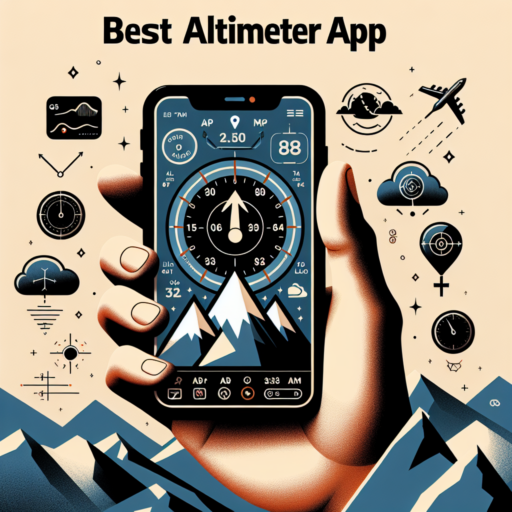
What is an Altimeter App and How Does it Work?
An altimeter app is a software application designed to measure an object’s altitude above a fixed level—typically the sea level. These applications utilize the barometric pressure sensor present in many smartphones and GPS technology to calculate altitude. They have become a handy tool for outdoor enthusiasts, hikers, and pilots who require accurate altitude readings without the need for traditional, bulky altimeter instruments.
The working mechanism behind an altimeter app revolves around the principles of atmospheric pressure and GPS data. When you’re at higher elevations, the atmospheric pressure decreases, and this change is captured by the barometric pressure sensor in your device. Meanwhile, GPS-based altimeters calculate your elevation by triangulating your position relative to multiple satellites. The app then combines this data to give a precise measurement of your current altitude.
Most altimeter apps also come with additional features such as tracking your ascent and descent, offering weather forecasts, and even integrating with maps to pinpoint your exact location. These functionalities enhance user experience, making altimeter apps a versatile tool not only for altitude measurement but also for planning outdoor activities.
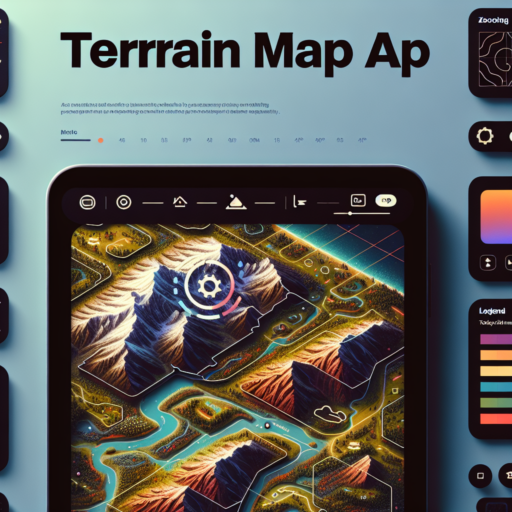
The Top Free and Paid Altimeter Apps for iOS and Android in 2023
Navigating through the vast selection of altimeter apps available for iOS and Android devices can be overwhelming, but 2023 has brought forth some standout applications that offer remarkable accuracy and features. Whether you are an avid hiker, a pilot, or someone who simply loves exploring the elevations around you, there’s an app tailored to meet your needs. Here, we focus on elucidating the top free and paid altimeter apps that have garnered attention for their precision, user-friendly interfaces, and unique functionalities.
Exceptional Free Altimeter Apps
Starting with the free altimeter apps, many users will be delighted to find applications that do not compromise on quality despite being available at no cost. Among the popular choices, certain apps stand out due to their integration of GPS technology and barometric pressure readings, offering users an accurate measurement of their current elevation. Noteworthy mentions include Altimeter Ler for iOS and Accurate Altimeter for Android. These apps not only provide elevation data but also come with added features such as weather forecasts and sunrise/sunset times, enhancing the outdoor experience without the need for any financial investment.
Premium Altimeter Apps Worth the Investment
For those willing to invest in a more comprehensive altimetry experience, the paid apps of 2023 offer sophisticated features that go beyond basic elevation measurements. Apps like Altimeter+ and Barometer & Altimeter Pro for both iOS and Android, come with a price tag but justify their cost with advanced functionalities such as real-time altitude graphing, customizable widgets, and more. These applications cater to the needs of professionals and outdoor enthusiasts who require accuracy and depth in their altitudinal information, making them indispensable tools for specific activities like mountain climbing and aviation.
In conclusion, the selection of altimeter apps in 2023 caters to a wide range of preferences and requirements. From the accuracy and simplicity of free apps to the advanced features of paid versions, users are spoilt for choice. As technology advances, we can only expect these applications to become even more reliable and feature-rich, offering precise elevation data at our fingertips. Whether you opt for a free app or a paid one, you’re guaranteed to have a valuable tool to aid in your elevation exploration endeavors.
Features to Look for in a High-Quality Altimeter App
When exploring outdoor activities that require elevation awareness, having a reliable altimeter app is critical for safety and navigation. A high-quality altimeter app not only provides accurate altitude readings but also enhances your outdoor experience with various supportive features. This guide highlights key features to look out for to ensure you’re equipped with the best possible technology on your adventures.
Accuracy and Calibration Options
The core functionality of an altimeter app is to measure your current altitude. Therefore, accuracy is paramount. The ability to calibrate using GPS data, barometric pressure (if your device supports it), or known elevations enhances reliability. Look for apps that offer multiple calibration methods to ensure accuracy in diverse environmental conditions.
Offline Accessibility
Many outdoor activities take place in remote areas where cellular service can be spotty or nonexistent. An altimeter app that offers offline access to critical data, including maps and saved routes, ensures you have essential information regardless of connectivity. This feature is invaluable for hikers, mountaineers, and anyone adventuring off the beaten path.
Integrated Weather Information
Changes in weather can greatly affect atmospheric pressure, impacting altitude readings and potentially your safety. High-quality altimeter apps often include integrated weather reports, providing real-time updates and forecasts. This feature helps you make informed decisions about your route and timing, taking into account incoming weather patterns.
How to Use an Altimeter App for Hiking and Outdoor Activities
Using an altimeter app for hiking and outdoor activities can greatly enhance your experience by providing you with detailed altitude and atmospheric pressure measurements. These apps are designed to help you understand your current elevation, which is crucial for navigation and safety in mountainous terrains. Firstly, ensure that your smartphone is compatible with the chosen altimeter app and that it’s calibrated correctly to ensure accuracy. Most apps will guide you through the calibration process, which may involve entering your current elevation manually or allowing the app to auto-calibrate using GPS data.
When you’re out on the trail, it’s important to keep an eye on the altimeter app to monitor changes in elevation. Significant elevation changes can inform you about potential challenges ahead, such as steep ascents or descents that may require extra caution. Additionally, understanding the atmospheric pressure changes can alert you to possible weather changes, which is vital for your safety during outdoor activities. It’s recommended to check the app regularly and compare its readings with physical map elevations if possible.
Many altimeter apps also offer additional features such as tracking your route, total ascent, and descent, which can be invaluable for planning future hikes or assessing the difficulty of your current route. To make the most of these features, start by familiarizing yourself with the app’s interface before your hike. Create a habit of recording your hikes to track your progress and review your path for any missed landmarks or possible shortcuts for future endeavors. This practice not only enhances your hiking experience but also your safety and enjoyment of the great outdoors.
Comparing Accuracy: Smartphone Altimeter Apps vs. Traditional Altimeters
When discussing navigational tools, the accuracy of altitude measurements is paramount, especially for activities such as hiking, mountaineering, and aviation. In recent years, smartphone altimeter apps have gained popularity as a convenient alternative to traditional altimeters. This comparison aims to shed light on how these modern apps stack up against their traditional counterparts in terms of accuracy.
Traditional altimeters measure altitude based on atmospheric pressure changes. These devices have been trusted by outdoor enthusiasts and professionals for decades due to their reliability and precision. They do not rely on any external power source, which makes them particularly useful in remote locations. However, their accuracy can be influenced by weather changes, requiring regular manual calibration to maintain precision.
Smartphone Altimeter App Accuracy
On the other hand, smartphone altimeter apps utilize the built-in barometric sensor present in modern smartphones, along with GPS data, to estimate altitude. The major advantage of these apps is their convenience, as they eliminate the need for carrying an additional device. However, the accuracy of smartphone apps can vary significantly. Factors such as the quality of the smartphone’s sensors, the app’s algorithm, and the availability and strength of GPS signal can all impact the precision of altitude measurements. Moreover, these apps typically require an active battery, which can be a limitation in long-duration activities without access to charging.
In evaluating the accuracy of smartphone altimeter apps versus traditional altimeters, it’s important to consider the intended use and the environment. For casual outdoor activities, smartphone apps may offer sufficient accuracy, while in scenarios where precise altitude readings are critical, traditional altimeters might still be the preferred choice. Given the variations in technology and personal preference, a comprehensive understanding of both options can guide users to make the best decision for their specific needs.
No se han encontrado productos.
User Reviews: The Best Altimeter Apps According to Experts and Enthusiasts
When it comes to finding the best altimeter apps, user reviews play a crucial role in guiding both experts and outdoor enthusiasts towards making informed decisions. These reviews, stemming from various experiences and needs, offer a window into the functionality, accuracy, and usability of the available apps. Moreover, they provide insights into how these tools perform under different environmental conditions, a factor that is key for those who rely on precise altitude readings during their adventures.
Experts often highlight the importance of choosing apps that not just provide accurate altitude readings but are also equipped with features that cater to the users’ specific outdoor activities. User reviews frequently mention the integration of weather forecasts, GPS tracking, and barometric pressure readings as essential features. Such functionalities not only enhance the overall experience but also ensure safety and preparedness in remote or challenging terrains. Recommendations from enthusiasts, on the other hand, tend to focus on ease of use and battery efficiency, elements that are crucial for long hikes or treks.
The community’s feedback has identified a handful of altimeter apps that consistently receive praise for their performance and reliability. Among these, certain names stand out due to their robust feature set, user-friendly interfaces, and positive user feedback across various platforms. While some apps are celebrated for their precision and advanced features, others are preferred for their simplicity and minimal battery consumption. However, it’s the blend of expert insights and real-world experiences reflected in user reviews that truly guide individuals towards the altimeters that best suit their outdoor adventure needs.
Maximizing Battery Life While Using an Altimeter App
Using an altimeter app on your smartphone or wearable device can significantly enhance your hiking or outdoor adventure experiences by providing precise altitude data. However, continuous use of GPS and altimeter functionalities tends to drain your device’s battery rapidly. Fortunately, there are effective strategies to extend battery life without compromising the benefits of your altimeter app.
Adjust App Refresh Rates and Background Usage
To minimize battery consumption, consider adjusting the refresh rate at which your altimeter app updates its data. By increasing the interval between updates, you reduce the workload on your device’s processor and GPS system. Additionally, managing apps running in the background can prevent unnecessary battery drain. Ensure that only essential apps are running alongside your altimeter to maximize battery efficiency.
Utilize Battery Saver Modes and External Power Sources
Modern devices come equipped with battery saver modes designed to extend battery life by limiting power usage by apps and the device’s hardware. Activating this mode while using your altimeter app can significantly extend your device’s operational time. For longer trips, carrying an external power bank or investing in portable solar chargers can provide a much-needed power boost, ensuring your altimeter app stays active throughout your adventure.
Implementing these strategies can drastically improve your device’s battery life, allowing you to rely on your altimeter app for longer periods without the inconvenience of frequent recharging. By managing app settings and embracing energy-efficient practices, you can enhance your outdoor experiences with continuous access to essential altitude data.
Troubleshooting Common Issues with Altimeter Apps
Altimeter apps, integral for outdoor enthusiasts for navigation and altitude measurement, can sometimes present issues that hinder their reliability. Knowing how to troubleshoot these common problems can enhance your outdoor experience. The following segments aim to guide users through common hurdles and their remedies.
Ensuring Accurate GPS Connectivity
One primary issue with altimeter apps is inaccurate altitude data, which often stems from poor GPS connectivity. To troubleshoot, ensure your device’s location services are enabled and set to the highest accuracy mode. Additionally, being in open spaces away from tall buildings or dense forests can improve GPS signal strength, thus enhancing the app’s accuracy. If problems persist, restarting your device or toggling the GPS off and on might help recalibrate your location services.
Calibration of the Altimeter Sensor
For devices with built-in altimeter sensors, calibration is key to accurate altitude readings. Regular calibration against known elevations can significantly improve precision. Access the calibration settings within the app or your device’s settings menu. Manual calibration options, if available, allow for finer adjustments based on current sea level pressure, which can vary with weather conditions and geographic location.
App Updates and Permissions
Outdated apps can lead to performance issues or inaccurate data. Ensure your altimeter app is up-to-date with the latest version, which usually includes bug fixes and improved functionality. Moreover, check that the app has all necessary permissions enabled, particularly for accessing location services. Restrictions in app permissions can interfere with how the app functions and accesses essential data for calculating altitude. Regular maintenance of these aspects can keep the altimeter app running smoothly.
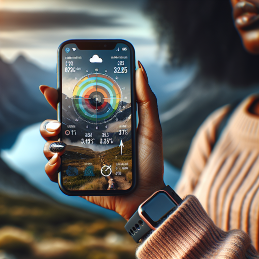
Futuristic Add-ons: Integrating Your Altimeter App with Wearable Devices
The realm of wearable technology is rapidly advancing, bringing us closer to a future where our gadgets seamlessly integrate into our daily lives. Among these technological advancements, the integration of altimeter apps with wearable devices stands out as a particularly fascinating development. This fusion not only enhances the functionality of wearable devices but also opens up new possibilities for outdoor enthusiasts and fitness aficionados alike.
When your altimeter app interfaces directly with your wearable device, it transforms the gadget into an indispensable tool for tracking elevation gains with unparalleled precision. This integration is especially beneficial for hikers, climbers, and skiers, enabling them to obtain real-time data about their altitude and adjust their plans accordingly. The beauty of this setup lies in its simplicity; users can access crucial information at a glance, without the need to pull out their smartphones or rely on less accurate methods.
Moreover, the integration of altimeter apps with wearable technology enhances the utility of devices we already wear daily, like smartwatches and fitness trackers. This means not only can you monitor heart rate, steps, and calories burned, but now also elevation gains during your outdoor adventures or even while climbing stairs throughout the day. It’s a feature that adds a whole new dimension to your fitness tracking, making your workouts more informative and ultimately, more rewarding.
FAQs: Everything You Need to Know About Altimeter Apps Before Downloading
When considering the download of an altimeter app, various questions may come to mind regarding their functionality, accuracy, and utility. Altimeter apps have become a crucial tool for outdoor enthusiasts, pilots, and anyone interested in measuring elevation above sea level. Here, we cover the most frequently asked questions to ensure you are well-informed before making your decision.
How Accurate Are Altimeter Apps?
One common question concerns the accuracy of altimeter apps. Most altimeter apps use GPS data or the barometric pressure sensor in your device to calculate elevation. Generally, GPS-based measurements offer accuracy within a range of 5 to 10 meters under open skies. Apps that use your device’s barometric pressure sensor can potentially offer even more precise readings, especially if they allow for manual calibration.
Do I Need an Internet Connection to Use Altimeter Apps?
Another vital aspect to consider is whether an altimeter app requires an internet connection. Many altimeter apps require internet access to download maps or elevation data. However, there are offline altimeter apps available that use your device’s built-in GPS to provide elevation information, making them perfect for remote outdoor adventures where cellular service is limited or non-existent.
Are Altimeter Apps Suitable for All Outdoor Activities?
Altimeter apps are incredibly versatile and can be used for a wide range of outdoor activities, including hiking, mountain biking, skiing, and even flying. However, the specific features you may need, such as the ability to track your ascent and descent or to save your elevation data over time, will depend on the activity. Selecting an app that catifies both your interests and needs ensures that you have the most beneficial tool at your fingertips.