What cycling speed does Google Maps use?
When it comes to planning a cycling route, one of the key pieces of information cyclists look for is how long it will take to reach their destination. This is where Google Maps comes into play. The cycling speed assumed by Google Maps is an average that caters to a broad range of users. Though Google has not publicly released the exact figure, it is widely believed that the platform estimates cyclists’ travel speed at around 10 to 12 miles per hour (16 to 19 km/h). This estimation helps users to calculate travel times relatively accurately for the average cyclist.
However, it’s important to note that this is a generalized speed. Individual cycling speeds can vary greatly due to several factors such as fitness level, type of bike, terrain, and road conditions. Urban areas with frequent stops, hills, or rough terrains can significantly affect actual travel times when compared to Google Maps’ estimations. To accommodate for these variations, Google Maps provides estimated arrival times with a degree of flexibility, but the foundational speed estimate remains a useful guideline for planning purposes.
Moreover, Google Maps continually updates cycling routes and data based on information gathered from users and various other sources. This ongoing process allows Google Maps to refine its travel time estimations, making them more accurate over time. For those seeking a more customized estimation, pairing Google Maps with cycling apps that track personal cycling speeds and patterns can offer a more tailored approach to route planning and travel time estimation.
Can you use Google Maps for cycling?
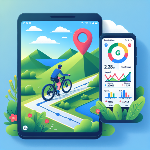
Absolutely, Google Maps can be an indispensable tool for cycling enthusiasts seeking to navigate routes more effectively. With its dedicated cycling feature, Google Maps offers cyclists the convenience of finding bike-friendly paths, lanes, and trails that might not be visible on traditional maps. Users can effortlessly customize their routes to suit their cycling preferences, whether looking for a leisurely ride or a challenging path.
The application’s user interface is straightforward, allowing cyclists to simply toggle the cycling option on the map to display available cycling routes. Google Maps displays routes colored in green, indicating dedicated lanes and trails, making it easier for cyclists to plan their journeys. Additionally, it provides valuable information such as elevation changes, estimated arrival times, and traffic conditions, which are crucial for a cyclist to know before setting out.
Apart from route planning, Google Maps helps cyclists to explore new cycling areas. With its extensive database, users can discover new trails and paths that are recommended by the cycling community. This fosters a sense of adventure, encouraging cyclists to try out new routes they might not have considered otherwise.
No se han encontrado productos.
How do I record cycling on Google Maps?
Recording your cycling activity on Google Maps is not a straightforward feature provided by Google Maps itself. However, with a bit of ingenuity and the use of additional apps, cyclists can effectively map out their routes and even share their journeys. This functionality is key for those looking to track their performance, plan their routes, or share their adventures with the cycling community.
First and foremost, to embark upon recording your cycling route, one must leverage Google My Maps or third-party app integration. Google My Maps allows users to customize and create their maps based on their cycling routes. Although it requires manual input, it’s a powerful tool for visualizing your cycling paths. On the other hand, third-party apps like Strava, MapMyRide, or Komoot offer a more dynamic way to record your rides automatically. These apps not only track your route but also provide data on your speed, elevation, and time. After recording, they allow for easy sharing to Google Maps.
Integrating with Google Maps: Once your cycling activity is recorded via a third-party app, you can share your accomplishments and routes on Google Maps. This process typically involves exporting your ride data from the app and then importing it into Google My Maps. This step is wonderfully straightforward for those looking to contribute their cycling insights and favorite routes to the broader Google Maps community.
Remember, while Google Maps may not offer direct cycling activity recording, the synergy between Google My Maps and various third-party apps ensures that cyclists have plenty of options for mapping out their rides, sharing their progress, and planning future cycling adventures.
How fast is the bike on Apple Maps?
Discerning the speed of a bike on Apple Maps requires considering various elements, unlike analyzing the speed of motorized vehicles. Biking speed on Apple Maps can significantly vary depending on a few core factors. These components shape the overall experience of biking route suggestions provided by the app, making it a tailored journey for each cyclist.
Key Factors Influencing Biking Speed
- Route Terrain: The topography of the planned route immensely impacts the average speed. Steeper inclines slow down progress, while downhill paths can increase speed.
- Rider’s Fitness: The physical condition of the biker plays a crucial role. A more fit cyclist can maintain higher speeds over longer distances.
- Bike Type: The design and efficiency of the bike also affect speed. For instance, road bikes are faster on paved surfaces compared to mountain bikes.
Apple Maps takes into account these and other environmental factors when suggesting biking routes, including current weather conditions and traffic. Therefore, while it doesn’t explicitly state a bike’s speed, it optimizes route suggestions for estimated times based on these encompassing variables.
Using historical data and real-time inputs, Apple Maps endeavors to provide the most accurate and efficient biking routes. This ambiguity in specifying bike speed stems from the dynamic nature of biking itself, making each cycling journey unique.