What is Altitude Measure and Why It’s Important
Altitude measure, simply put, is the height of an object or point in relation to sea level or ground level. This measurement is crucial in various fields, including aviation, hiking, and satellite positioning, to name a few. Understanding the accurate altitude of an area or object plays a pivotal role in ensuring safe and efficient operations in these disciplines.
One primary reason altitude measure is so important is its role in aviation safety. Aircraft pilots rely heavily on altitude readings to maintain a safe flight level above the ground, especially when flying in mountainous or uneven terrain. Accurate altitude information helps prevent accidents by ensuring that there is sufficient clearance between the aircraft and the ground or any obstacles.
Additionally, in activities such as hiking and mountaineering, knowing the altitude is essential for navigation and safety. It helps hikers prepare for potential changes in weather, which can be drastically different at higher altitudes. Moreover, understanding elevation gain during hikes allows for better physical preparation and health precaution.
In conclusion, the significance of altitude measure extends beyond its basic definition. Its application across various industries underlines the need for precise and reliable altitude data.
The Different Tools Used for Measuring Altitude
Measuring altitude is crucial for various applications, from aviation and hiking to environmental science. With advancements in technology, the tools available for this purpose have evolved significantly. Each tool offers unique features that cater to the needs of different users and scenarios. Understanding the spectrum of these devices can enhance precision and reliability in altitude measurement.
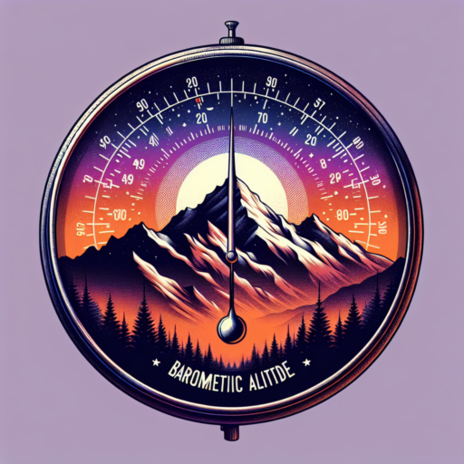
Barometric Altimeters
One of the most traditional methods involves the use of Barometric Altimeters. These instruments measure altitude by calculating atmospheric pressure. As elevation increases, air pressure decreases, providing a means to estimate altitude above sea level. While highly effective under stable weather conditions, it’s essential to note that barometric pressure changes with weather, which can impact accuracy. Regular calibration against known elevations is necessary for optimal performance.
GPS Devices
In contrast, GPS Devices offer a modern approach to altitude measurement. Utilizing signals from satellites orbiting the earth, GPS devices can precisely determine one’s location and elevation. They are not only more resistant to weather-related inaccuracies but also provide global coverage. However, their performance can be affected by obstacles that block satellite signals, such as tall buildings or dense forests, limiting their effectiveness in certain environments.
Each tool used for measuring altitude has its own set of advantages and limitations, making them more suited for specific tasks and conditions. Whether it’s the traditional barometric altimeter or the technologically advanced GPS device, choosing the right tool can significantly impact the accuracy of your altitude readings.
Understanding Altitude Measurements in Aviation
In the realm of aviation, understanding how altitude is measured is fundamental for both pilots and aviation enthusiasts alike. Altitude, in its essence, refers to the height of an object in relation to the sea level or ground level. However, when it comes to aviation, this seemingly straightforward concept splits into multiple categories, each serving a unique purpose and being measured in a different way.
The Basic Types of Altitude
- Indicated Altitude: This is the altitude shown on the altimeter in the cockpit and is based on the atmospheric pressure at the aircraft’s current location. It’s the most direct form of altitude measurement but can be affected by atmospheric pressure changes.
- Absolute Altitude: The vertical distance between the aircraft and the terrain directly below it. This form of altitude is crucial for avoiding ground obstacles and for low-level navigation.
- True Altitude: This is the actual height above mean sea level (AMSL) and is considered the most accurate form of altitude. True altitude takes into consideration the atmospheric conditions and must often be calculated rather than directly measured.
Each type of altitude has its application and importance in various phases of flight, from takeoff to cruising and landing. For example, indicated altitude is primarily used during most phases of a flight, whereas true altitude becomes particularly relevant when flying at high altitudes or when precise navigation is necessary.
Given the critical role of altitude readings in ensuring the safety and efficiency of flights, modern avionics have evolved to offer sophisticated instruments that can measure and display these different forms of altitude with high accuracy. Nevertheless, understanding the basis upon which these measurements rest is essential for interpreting the data correctly and making informed decisions during flight operations.
How to Measure Altitude in Hiking and Mountaineering
Measuring altitude accurately is crucial for any outdoor enthusiast engaged in hiking or mountaineering. The elevation information can help hikers navigate more effectively, prepare for potential altitude sickness, and understand the topography of the landscape. There are various methods and tools that can be utilized to measure altitude, each with its own set of advantages.
Using a GPS Device
One of the most accurate ways to measure altitude while hiking or mountaineering is through a GPS device. Modern GPS devices are not only capable of providing precise location coordinates but also elevation data. This data is especially useful in remote areas where traditional maps may not be as accurate. It is important, however, to ensure that your GPS device is fully charged and that you’re familiar with its features before heading out.
Altimeter Watches
Altimeter watches are a popular choice among outdoor enthusiasts for measuring altitude. These devices use barometric pressure to estimate your current elevation. It’s crucial to calibrate your altimeter watch at known elevations for the most accurate readings. Despite their convenience, it’s worth noting that sudden weather changes can affect the accuracy of altimeter watches, making it essential to use them alongside other methods when possible.
Understanding and measuring altitude effectively can enhance your hiking or mountaineering experience significantly. By accurately assessing your elevation, you can better prepare for the challenges ahead, manage your energy levels, and ensure a safer journey through the great outdoors.
No se han encontrado productos.
Altitude Measurement Technologies: From Traditional to Modern
The evolution of altitude measurement technologies reflects a significant journey from analog methods to digital sophistication. Throughout history, these advancements have played a crucial role in various fields including aviation, mountaineering, and geography. This transformation has led to more accurate, accessible, and efficient techniques for determining altitude.
Traditional Altitude Measurement Methods
Traditionally, altitude measurement was heavily reliant on physical tools and natural phenomena. One of the earliest tools, the barometer, uses atmospheric pressure to gauge altitude, a principle first conceptualized by Evangelista Torricelli in the 17th century. Similarly, trigonometric levelling involves mathematical calculations based on angles surveyed from a known starting point, offering another method without the need for modern technology.
Modern Altitude Measurement Technologies
The leap to modern altitude measurement technologies has introduced a myriad of electronic devices designed to offer precise data. The Global Positioning System (GPS), for instance, uses satellites to provide exact altitude readings regardless of the observer’s location on Earth. Additionally, radar altimeters, which measure the distance between aircraft and terrain by bouncing radio waves off the surface, have become essential in aviation for ensuring flight safety.
As technology progresses, the integration of artificial intelligence and machine learning continues to refine the accuracy and reliability of altitude measurements. This transition from traditional to modern methodologies not only marks a milestone in technological evolution but also underscores the growing importance of precise altitude data in today’s data-driven world.
Comparing GPS, Barometric, and Radar Altitude Measuring Techniques
Understanding the differences between GPS, barometric, and radar altitude measuring techniques is essential for a wide range of applications, from aviation and hiking to meteorology. Each method has its unique mechanisms and applications, making them more suitable for specific environments and tasks. By exploring the nuances of these techniques, users can better select the most appropriate method for their altitude measuring needs.
GPS Altitude Measurement
Global Positioning System (GPS) altitude measuring leverages a network of satellites to determine a position’s altitude relative to sea level. This method is highly reliant on the quality of satellite signals and the receiver’s technology. One of the main advantages of GPS altitude measurement is its global availability, offering consistency and accessibility for users worldwide. However, its accuracy can be affected by atmospheric conditions, satellite geometry, and signal multipath effects, which may lead to discrepancies in altitude readings.
Barometric Altitude Measurement
Barometric altitude measurement, on the other hand, works by measuring the air pressure at a certain altitude and comparing it to a predefined reference level. This technique is sensitive to changes in atmospheric conditions, which can significantly influence air pressure and, consequently, altitude readings. It’s paramount for users of barometric altitude measurement to regularly calibrate their instruments to account for atmospheric pressure changes. Although susceptible to weather variations, this method is highly valued in aviation for its relative accuracy in establishing an aircraft’s altitude above the ground.
Radar Altitude Measurement
Radar altitude measurement distinguises itself by emitting radio waves downwards from an aircraft or other platforms and measuring the time it takes for the waves to bounce back from the ground surface. This direct measurement of distance to the ground surface makes radar altitude measurement exceptionally accurate, especially when determining the altitude above terrain. It is particularly useful for low-flying aircraft, ensuring flight safety by providing precise altitude data over uneven ground or water surfaces. Despite its benefits, radar systems can be bulky and expensive, limiting their use to specific professional and military applications.
Applications of Altitude Measurements in Geography and Earth Sciences
In the realms of geography and earth sciences, altitude measurements serve as indispensable tools, offering insights into a myriad of phenomena that shape our planet. These measurements, by delineating the height of locales or objects on the Earth’s surface relative to sea level, enable professionals and researchers to engage in a more nuanced understanding and analysis of terrestrial features and environmental conditions.
Climate Studies and Weather Prediction
Altitude possesses a direct influence on climate patterns and weather phenomena. Through robust altitude data, scientists can unravel the complexities of climatic variations across different elevations. For instance, higher altitudes are typically associated with cooler temperatures, a fundamental principle that underlies studies of mountain climates and their biodiversity. Similarly, in the domain of meteorology, precise altitude measurements are crucial for the calibration of atmospheric models, which are foundational in weather prediction and assessing the impact of climate change on specific regions.
Mapping and Terrain Analysis
In addition to climatic studies, altitude measurements are pivotal in the mapping and analysis of our planet’s diverse terrains. Modern Geographic Information Systems (GIS) and remote sensing technologies rely heavily on accurate altitude data to generate detailed topographic maps. These maps not only serve educational and exploratory purposes but also are critical in planning infrastructure projects, such as roads, bridges, and dams. Furthermore, they play an essential role in natural hazard assessment, enabling scientists and disaster response teams to predict and mitigate the risks posed by floods, landslides, and earthquakes.
Environmental Conservation and Management
Altitude measurements are also significant in the context of environmental conservation and management. By providing detailed information on elevation, researchers can identify unique ecosystems and habitats that flourish at specific heights. This data facilitates the targeted conservation of endangered species and the management of protected areas. Moreover, understanding the altitude can lead to better resource management, such as the strategic placement of wind farms and the assessment of water catchment areas for sustainable hydrological planning.
Through these examples, it becomes evident that altitude measurements are valuable, if not indispensable, in a wide range of applications within geography and earth sciences. By enabling a deeper comprehension of environmental patterns and terrestrial dynamics, these measurements contribute significantly to our ongoing efforts to study, preserve, and sustainably manage the Earth’s natural resources and environments.
Improving Accuracy in Altitude Measurement: Tips and Techniques
Measuring altitude accurately is crucial for various applications, from aviation and hiking to geography and climate sciences. Recent advancements have made significant strides in improving precision, yet challenges remain. This section outlines essential tips and techniques integral to enhancing the accuracy of altitude measurements.
Understanding the Basics of Altitude Measurement Tools
At the core of accurate altitude measurement is a deep understanding of the tools and technologies available. Barometric pressure sensors, GPS devices, and radar altimeters each have unique benefits and limitations. For instance, GPS devices are renowned for their versatility and global applicability but can be less accurate in dense urban areas or thick forests. Conversely, barometric pressure sensors offer precision by accounting for atmospheric pressure changes, but their accuracy hinges on regular calibration and possibly, real-time weather data integration.
Calibration and Maintenance: The Underrated Heroes
Regular calibration and maintenance of measuring instruments are paramount. Even the most advanced tools can yield inaccurate results if not properly calibrated or if they’ve fallen out of sync due to environmental factors or wear and tear. Implementing a stringent maintenance schedule ensures that instruments are not only accurate but also reliable over time. This includes frequent calibration against known altitude benchmarks, as well as physical inspections and software updates.
- Utilize Multiple Data Sources: Cross-verifying altitude data from various sources enhances measurement accuracy.
- Incorporate Real-Time Corrections: Adjustments based on real-time weather data can significantly improve barometric measurements.
- Embrace Modern Technologies: New advancements in satellite geodesy and drone technology offer promising improvements in altitude measurement precision.
Future Trends in Altitude Measuring Devices and Techniques
Exploring the horizon of modern avionics and adventure gear, the future of altitude measuring devices and techniques beckons with transformative potential. Innovations aimed at enhancing accuracy, reliability, and integration are set to redefine our understanding and interaction with high-altitude environments. As we look ahead, several forward-thinking trends are poised to elevate the capabilities of both casual adventurers and professional explorers.
Integration of IoT and Wearable Technologies
In the realm of altitude measurement, the integration of the Internet of Things (IoT) and wearable technologies stands as a significant leap forward. Future devices are expected to not only measure altitude but also sync in real-time with a suite of other sensors and devices. This interconnected web of data will offer insights into environmental conditions, providing a holistic overview of the user’s surroundings. The seamlessness of this integration will enhance safety and decision-making, particularly in challenging terrains.
Advanced Satellite Technologies
The deployment of more sophisticated satellite technologies promises a new era of altitude measuring devices that boast unprecedented accuracy. These advancements are likely to leverage enhanced GPS systems and global navigation satellite systems (GNSS), offering precision previously unattainable. Users can anticipate devices that can pinpoint their exact altitude to within a few centimeters, revolutionizing navigation and mapping in remote or uncharted territories.
Moreover, the push for miniaturization and power efficiency in devices will allow users to access highly accurate altimetry data without compromising on portability or battery life. The focus on user-centric design means that these future devices will not only perform better but also be more intuitive and easier to use in challenging conditions. As these technologies evolve, the line between professional-grade equipment and consumer gadgets will blur, bringing high-precision altitude measuring capabilities to a wider audience.