Understanding the Basics: GPS vs GNSS
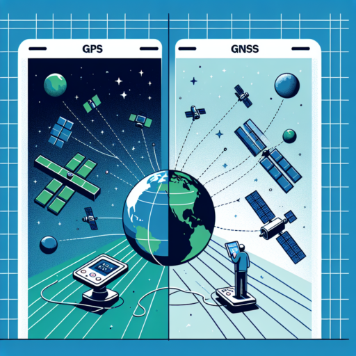
When discussing location and navigation technologies, two terms frequently come up: GPS (Global Positioning System) and GNSS (Global Navigation Satellite System). While they are often used interchangeably, there are distinct differences between GPS and GNSS that are crucial to understand. This differentiation is not just in their operational mechanisms but also in their coverage, precision, and application areas.
Distinguishing Features between GPS and GNSS
GPS is a navigation system that was developed and is maintained by the United States. It operates through a network of about 31 satellites orbiting the Earth. GPS has become synonymous with satellite-based navigation systems but it is actually a subset of GNSS. The system provides geolocation and time information to a GPS receiver anywhere on the Earth where there is an unobstructed line of sight to four or more GPS satellites.
GNSS, on the other hand, encompasses a broader spectrum of satellite navigation systems, including GPS (United States), GLONASS (Russia), Galileo (European Union), and BeiDou (China). GNSS offers global coverage by using more satellites, resulting in increased accuracy, reliability, and redundancy. It represents the collective array of satellite navigation systems operating globally.
Understanding the difference between GPS and GNSS is fundamental for anyone involved in geospatial sciences, navigation technology, and related fields. While GPS might be the most well-known system due to its early development and widespread use, GNSS brings to the table enhanced capabilities by incorporating multiple satellite constellations, thus providing a more robust solution for precision navigation and timing services worldwide.
How Does GPS Work?
The Global Positioning System (GPS) is a marvel of modern technology that enables users worldwide to determine their precise location on Earth at any given time. At its core, GPS functions through a network of satellites that orbit the Earth, which are constantly transmitting signals. These signals, when intercepted by a GPS receiver, provide the necessary data to calculate the user’s exact position by a process known as trilateration.
The Role of Satellites in GPS
For GPS to work effectively, it relies on a constellation of at least 24 satellites, although there are typically more to ensure redundancy and increased accuracy. These satellites, situated approximately 20,000 kilometers above the Earth’s surface, follow precise orbits and transmit signals that contain critical information such as the satellite’s location and the exact time the signal was sent.
GPS Signal Processing
A GPS receiver, which can be found in many devices such as smartphones, cars, and dedicated GPS units, captures the transmitted signals from multiple satellites. By analyzing the time delay between when the signal was sent and when it was received, the device can calculate its distance from each satellite. With signals from at least four satellites, the receiver uses trilateration to determine its three-dimensional location (latitude, longitude, and altitude) on Earth.
The accuracy of GPS can vary depending on factors such as signal obstruction by buildings or natural terrain, atmospheric conditions, and the quality of the GPS receiver. However, advancements in technology and algorithms have significantly improved precision, making GPS an indispensable tool for navigation, mapping, and numerous other applications.
Exploring GNSS and Its Global Coverage
The Global Navigation Satellite System (GNSS) represents a marvel of modern technology, encompassing a system of satellites that provide signals from space transmitting positioning and timing data to GNSS receivers, which in turn use this data to determine location. The beauty of GNSS lies in its comprehensive global coverage, enabling a myriad of applications from navigation to mapping and beyond. This system is not just a singular entity but a constellation of several satellite systems operated by different countries around the globe.
The Components and Functionality of GNSS
At the heart of GNSS’s global coverage are the satellite constellations operated by various countries, including the United States’ GPS, Russia’s GLONASS, the European Union’s Galileo, and China’s BeiDou. These systems work in concert to provide global coverage, ensuring that at any point on the Earth’s surface, a receiver can pick up signals from multiple satellites. This redundancy improves accuracy, reliability, and availability of positioning information, which is critical for applications where precision is paramount.
Enhancing Global Reach and Accuracy
The advancement in GNSS technology has significantly improved over the years, offering enhanced global reach and accuracy. Modern GNSS receivers are capable of connecting to multiple satellite systems simultaneously, a feature known as multi-GNSS support. This capability not only extends the global coverage but also significantly enhances the accuracy of location-based services. Furthermore, the ongoing efforts to upgrade existing satellites and launch new ones continue to improve the system’s resilience and precision, making GNSS an indispensable tool for global navigation and beyond.
Key Differences Between GPS and GNSS
Understanding the key differences between the Global Positioning System (GPS) and the Global Navigation Satellite System (GNSS) is crucial for leveraging their unique capabilities in various applications. At the core, GPS is a subset of GNSS, highlighting a fundamental relationship yet significant distinctions in their functionalities, coverage, and technology.
The first major difference lies in their coverage. GPS, being a pioneer in global navigation, operates through a constellation of approximately 31 satellites orbiting the Earth. This setup allows for precise location tracking across the globe. On the other hand, GNSS encompasses additional satellite systems, including Russia’s GLONASS, Europe’s Galileo, and China’s BeiDou, offering a more robust and comprehensive coverage by using a combination of these satellites.
Another critical distinction is their accuracy and reliability. GPS provides commendable accuracy; however, GNSS systems take this a notch higher by utilizing cross-referencing satellites from multiple systems. This integration enhances positional accuracy and improves reliability in challenging conditions, such as urban canyons where signals can be obstructed. GNSS’s ability to pull data from more satellites also means that it can provide service even when certain satellite systems are experiencing downtime or maintenance, ensuring uninterrupted global coverage.
Applications of GPS and GNSS in Everyday Life
In our fast-paced world, GPS (Global Positioning System) and GNSS (Global Navigation Satellite System) technologies have become integral components of everyday life, seamlessly facilitating a wide range of activities. These satellite-based navigation systems offer precise location and time information, anywhere on Earth, under any weather conditions, as long as there is an unobstructed line of sight to four or more GPS satellites.
Navigation and Tracking is undoubtedly the most recognized application of GPS and GNSS technologies. From guiding you to an unfamiliar destination to tracking delivery vehicles in real-time, these systems have revolutionized how we move and monitor assets. Mobile apps, in-vehicle navigation systems, and portable navigators rely on GPS/GNSS to provide turn-by-turn directions, estimated times of arrival, and alternative routes to avoid traffic congestion.
Another vital application is in Emergency Response and Disaster Management. GPS and GNSS play crucial roles in responding to emergencies and natural disasters by enabling accurate location tracking of individuals in need of assistance. They also support disaster management efforts by mapping affected areas, coordinating relief operations, and aiding in the efficient deployment of resources. Emergency response teams can reach victims more swiftly, and with better preparations, thanks to detailed, real-time information from satellite navigation systems.
Additionally, Environmental Monitoring has greatly benefited from the advancements in GPS and GNNSS technologies. Scientists and researchers utilize these systems to study climate change, monitor wildlife movements, and manage natural resources. By providing precise data on Earth’s movements, satellite navigation aids in predicting natural disasters, tracking endangered species, and monitoring changes in the environment. This information is vital for creating strategies to mitigate the impacts of climate change and protect our planet’s biodiversity.
GPS and GNSS technologies have woven themselves into the fabric of everyday life, offering an array of benefits across various sectors. From simplifying commutes to safeguarding communities and preserving the environment, their applications are as expansive as they are essential.
Accuracy and Performance: GPS Compared to GNSS
When discussing navigation technologies, the comparison between Global Positioning System (GPS) and Global Navigation Satellite System (GNSS) is inevitable. Both systems play crucial roles in the world of geolocation services, but they differ significantly in terms of accuracy and performance.
GPS, a subset of GNSS, is widely known for its presence in everyday devices such as smartphones and car navigation systems. It primarily relies on a constellation of approximately 32 satellites orbiting the Earth. However, GNSS encompasses a broader spectrum, including other satellite constellations such as GLONASS (Russia), Galileo (Europe), and Beidou (China). This amalgamation of satellites under the GNSS umbrella offers superior accuracy compared to GPS alone due to the increased number of satellites available for triangulation.
Another critical factor to consider is performance in challenging environments. GPS’s effectiveness can significantly diminish in urban canyons, dense forests, or near tall buildings due to signal obstructions. In contrast, GNSS, with its access to multiple satellite constellations, can often provide more consistent and reliable coverage in these tricky areas. This is because GNSS devices can pick the best signals from a larger pool of satellites, enhancing positional accuracy and reducing the time to first fix (TTFF).
Future Developments in Global Navigation Satellite Systems
The landscape of Global Navigation Satellite Systems (GNSS) is rapidly evolving, promising significant advancements in accuracy, reliability, and functionality for users around the globe. As technology progresses, these systems are set to become more integral to daily life and various sectors, including transportation, agriculture, and emergency response.
One of the key areas of development is the integration of GNSS with other emerging technologies such as 5G networks, Internet of Things (IoT), and artificial intelligence (AI). This convergence aims to enhance the precision of location services, reduce latency, and support the autonomous operation of vehicles and drones. Moreover, advancements in chip technology are expected to make GNSS devices more power-efficient, smaller, and cheaper, thus expanding their applicability across different industries.
Another significant focus is on improving the resilience and security of GNSS. As reliance on these systems grows, so does the potential impact of disruptions caused by natural phenomena or intentional attacks. Efforts are underway to develop more robust signal structures, enhance signal authentication, and implement multi-frequency and multi-system receivers that can switch between different GNSS sources to maintain accuracy and availability.
No se han encontrado productos.
Choosing Between GPS and GNSS for Your Navigation Needs
When deciding on the most suitable navigation technology for your requirements, understanding the distinctions between Global Positioning System (GPS) and Global Navigation Satellite System (GNSS) is crucial. GPS, a widely recognized navigation system, operates by using satellites specifically deployed by the United States. In contrast, GNSS encompasses a broader spectrum, incorporating additional satellite constellations operated by other countries. This fundamental difference is a primary consideration in determining which system best aligns with your navigational needs.
The choice between GPS and GNSS often hinges on the specific demands of your application. For instance, GPS has been the backbone of navigational aids around the world, providing reliable location data under various conditions. However, GNSS offers an enhanced level of accuracy and reliability by leveraging multiple satellite constellations. This can be particularly beneficial in challenging environments where GPS signals might be obstructed, such as urban canyons or heavily forested areas.
Factors to Consider
- Accuracy Requirements: GNSS, with access to numerous satellites, generally delivers better accuracy than GPS alone. This is pivotal in applications where precision is paramount.
- Global Coverage: For users who need consistent, reliable coverage across the globe, GNSS, with its diverse satellite constellations, provides a distinct advantage over GPS.
- Cost Implications: Investing in GNSS technology can be more costly upfront, but for certain applications, the enhanced performance justifies the additional expenditure.
Understanding the capabilities and limitations of both GPS and GNSS is essential for making an informed decision. Whether your priority is the precision of location data, the breadth of coverage, or cost considerations, weighing these factors will guide you in selecting the navigation system that best suits your needs.