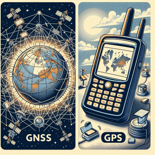
Understanding GNSS GPS System: What You Need to Know
The Global Navigation Satellite System (GNSS) represents a constellation of satellites that provide signals from space transmitting positioning and timing data to GNSS receivers. These receivers then use this data to determine location. The Global Positioning System (GPS) is a part of this vast network, specifically managed by the United States government, and is one of the most widely recognized GNSS systems globally.
Understanding the GNSS GPS system is fundamental for a wide range of applications, from navigating unfamiliar cities to conducting sophisticated scientific research. The system’s accuracy and reliability depend on a complex interplay between the satellite signals, atmospheric conditions, and the technology used in GNSS receivers. Despite potential challenges such as signal obstruction from buildings or natural features, advances in GNSS technology continue to enhance its precision and user experience.
One key aspect that users need to know about the GNSS GPS system is its global availability and versatility. Unlike some navigation aids that are limited in scope and reach, GNSS GPS offers worldwide coverage. This universal accessibility makes it indispensable for international logistics, emergency response coordination, and mobile phone location services, among others.
The Benefits of Using a GNSS GPS System for Navigation
Global Navigation Satellite Systems (GNSS), including the widely known GPS, offer unparalleled accuracy and reliability for navigation purposes. Incorporating signals from multiple satellite constellations, GNSS GPS systems enhance traditional navigation methods in several critical areas. Their use spans across various sectors, from aviation to personal vehicle navigation, redefining the way we explore and understand our world.
Enhanced Accuracy and Reliability
The primary advantage of employing a GNSS GPS system is enhanced accuracy and reliability in location tracking. Unlike traditional GPS that relies on a single satellite constellation, GNSS systems amalgamate data from multiple constellations, ensuring more precise and dependable positioning. This improvement is vital in environments where precision is paramount, such as in emergency services or in the aviation industry.
Global Coverage and Availability
Another significant benefit is global coverage and availability. GNSS GPS systems are not restricted by geographical boundaries, providing consistent and uninterrupted service worldwide. This universal coverage is critical for international logistics operations, facilitating seamless navigation across borders without the need for multiple navigation devices or systems.
Adaptability to Varied Applications
Lastly, the versatility of GNSS GPS systems enables their adaptation to a wide range of applications. From high-precision farming equipment that helps in achieving efficient agricultural practices to urban planning and disaster management, the adaptability of GNSS technology offers solutions that are both innovative and effective. This flexibility ensures that regardless of the domain, users can leverage the technology to enhance operational efficiency and safety.
No se han encontrado productos.
How Does a GNSS GPS System Work? A Comprehensive Guide
The Global Navigation Satellite System (GNSS) GPS is a marvel in modern navigation, enabling users worldwide to pinpoint their exact location, speed, and the time, on any day, under any weather conditions. The working of a GNSS GPS system is a testament to human ingenuity, harnessing the power of satellites orbiting the Earth to facilitate unprecedented levels of global positioning accuracy. Let’s delve into the core of how this cutting-edge technology operates.
Constellation of Satellites
At the heart of the GNSS GPS system lies a constellation of at least 24 satellites, continuously orbiting the Earth. These satellites are strategically placed in six Earth-centered orbital planes, ensuring that at any given time, anywhere on the planet, there are at least four satellites visible to a receiver. This critical aspect of satellite distribution is what enables a GNSS GPS receiver to calculate its exact position by acquiring signals from these satellites.
Triangulation Process
The triangulation method is fundamental to how GNSS GPS systems determine one’s location. Upon receiving the signals transmitted by the satellites, a GNSS receiver employs the principle of triangulation to ascertain its precise position on Earth. This process involves calculating the distance between the receiver and each of the at least four satellites, using the time it takes for each satellite’s signal to reach the receiver. By intersecting these distances, the GNSS GPS system can pinpoint the receiver’s location with remarkable accuracy.
Signal Transmission and Calculation
The intricacy of GNSS GPS technology extends to how signals are transmitted and processed. Each satellite in the GNSS constellation transmits information about its position and the current time at regular intervals. This signal, which travels at the speed of light, reaches GNSS receivers, allowing them to compute their exact location by calculating the time difference between the moment the signal was sent from the satellite and when it was received. It’s this calculated time delay that is instrumental in determining the distance from each satellite, thereby enabling precise location mapping.
Comparing GNSS GPS System with Other Navigation Techniques
In the realm of navigation and positioning, the GNSS (Global Navigation Satellite System) and GPS (Global Positioning System) have emerged as paramount technologies. These systems provide critical data for various applications, from automotive navigation to smartphone location services. However, comparing the GNSS GPS system with other navigation techniques sheds light on their unique benefits and limitations.
Accuracy and Reliability of GNSS GPS
The GNSS, which encompasses systems like GPS (USA), Galileo (Europe), GLONASS (Russia), and BeiDou (China), offers unparalleled accuracy. By utilizing multiple satellite systems, GNSS can provide more accurate location information, typically within a few meters. This is in sharp contrast to other traditional navigation methods, such as VOR (VHF Omnidirectional Range) used in aviation, which can have a significantly higher margin of error. Moreover, the multi-constellation setup of GNSS enhances reliability, ensuring that position data is available even in areas where one system’s signal might be weak or obstructed.
Global Coverage and Availability
One of the primary advantages of the GNSS GPS system over other navigation techniques is its comprehensive global coverage. Systems like LORAN (Long Range Navigation) are limited by geographical range and cannot provide the worldwide reach that GNSS offers. Whether in the remote corners of the Earth or bustling urban centers, GNSS ensures consistent accessibility. This universal availability is crucial for global maritime and aviation routes, as well as for individuals relying on accurate location information.
Integration with Modern Technology
The integration of GNSS GPS systems into modern technology underscores their superiority over older navigation methods. From smartphones and wearables to drones and autonomous vehicles, GNSS capabilities are embedded into today’s digital infrastructure. This seamless integration enables a wide array of applications, such as real-time tracking, emergency services, and enhanced 3D mapping. In comparison, other navigation techniques, while still useful in specific contexts, lack this level of adaptability and cannot easily be incorporated into the technologies shaping our future.
In summary, when comparing the GNSS GPS system with other navigation techniques, it becomes evident that GNFS’s accuracy, reliability, global coverage, and integration with modern technology set it apart. While other methods have their place, the comprehensive capabilities of GNSS GPS make it indispensable in our increasingly globalized and tech-driven world.
Installing and Setting Up Your First GNSS GPS System
Getting started with your first GNSS (Global Navigation Satellite System) GPS system can feel daunting, but with a few guidelines, the process becomes straightforward. GNSS GPS technology enhances traditional GPS systems by utilizing multiple satellite constellations, offering more accurate and reliable location data. Whether you’re setting up a system for personal use or integrating it into larger operational frameworks, understanding the installation and setup basics is crucial.
Choosing the Right GNSS GPS System
Before diving into the installation process, selecting the right GNSS GPS system for your needs is the first critical step. Consider the operational environment, required accuracy levels, and specific features like real-time tracking or multi-frequency support. Options vary from highly sophisticated models designed for geospatial professionals to more accessible units for amateur explorers.
Understanding the Installation Requirements
Once you’ve chosen a system, familiarizing yourself with the installation requirements is essential. Most GNSS GPS devices require a clear view of the sky to receive satellite signals effectively. Therefore, the device’s placement plays a pivotal role in its operational efficiency. In vehicles, this might mean installing an external antenna on the roof. For handheld devices, ensuring an unobstructed sky view during use is key. Additionally, some systems may require specific software installations or updates before they can be fully operational.
Installation also involves setting up the software that comes with your GNSS GPS system. This might include downloading applications to your computer or smartphone, entering device-specific codes, and going through an initial configuration process. Thoroughly review the user manual provided with your device, as it will have detailed instructions tailored to your specific model. Remember, accurate setup is essential for ensuring the reliability and accuracy of your GNNS GPS system.
Top Applications of GNSS GPS Systems in Daily Life
In today’s fast-paced world, Global Navigation Satellite Systems (GNSS), including Global Positioning System (GPS) technology, have become an indispensable part of everyday life. The applications of GNSS GPS systems are vast and varied, touching numerous aspects of our daily activities.
One of the primary uses of GNSS GPS systems is in navigation and transportation. Whether it’s for personal vehicle navigation, public transportation management, or logistics and shipping, GPS provides critical location and time information that makes efficient and safe travel possible. Drivers and passengers rely on GPS to determine the best routes to avoid traffic, thus saving time and reducing fuel consumption.
Enhanced Safety and Emergency Response
Another vital application is in enhancing safety and supporting emergency response operations. GPS systems are crucial in emergency services, allowing responders to reach people in need quickly. For instance, when someone dials an emergency number from a GPS-enabled device, responders can use this information to locate the caller with remarkable accuracy. Moreover, GPS plays a crucial role in disaster management and recovery by helping to map affected areas swiftly and accurately.
Everyday Convenience and Fitness Tracking
On a more personal level, GNSS GPS systems have revolutionized how we stay fit and organize our daily lives. Fitness enthusiasts use GPS-enabled devices to track their activities, monitor progress, and plan workouts. Applications that combine GPS with local weather forecasts also enable individuals to plan their days better, enhancing personal efficiency and convenience in everyday tasks.
Optimizing Accuracy: Tips and Tricks for GNSS GPS System Users
Improving the accuracy of your GNSS GPS system can dramatically enhance your navigation experience, whether it’s for personal exploration, professional surveying, or advanced geocaching. In the world of Global Navigation Satellite Systems (GNSS), achieving the highest level of precision is often the name of the game. Here, we explore key strategies that users can employ to fine-tune the performance of their devices.
Understand Environmental Impact
Environmental factors play a crucial role in the performance of GNSS GPS systems. Tall buildings, dense foliage, and even atmospheric conditions can interfere with signal quality. Users looking to optimize accuracy should aim to operate their devices in more open spaces where the sky is clearly visible. Additionally, being aware of the weather and planning your navigation activities accordingly can mitigate potential signal disruptions caused by atmospheric disturbances.
Device Calibration and Updates
Regularly calibrating your GNSS GPS unit and ensuring it has the latest firmware and software updates installed is vital. Manufacturers often release updates that enhance signal processing and improve user experience. Calibration helps the device more accurately interpret satellite signals, leading to improved accuracy. Users should refer to their device’s manual for specific calibration instructions and make it a habit to check for updates regularly.
Utilize Augmentation Systems
For users seeking to enhance the precision of their GNSS GPS systems further, turning to augmentation systems like WAAS (Wide Area Augmentation System) or EGNOS (European Geostationary Navigation Overlay Service) can be a game-changer. These systems are designed to improve the accuracy, integrity, and availability of satellite navigation signals, making them invaluable tools for users who require the utmost precision in their navigational tasks.
Frequently Asked Questions About GNSS GPS Systems
When it comes to understanding GNSS (Global Navigation Satellite System) and GPS (Global Positioning System) technologies, there are numerous questions that users and enthusiasts frequently ask. Below, we delve into some of the key queries to provide clarity on these sophisticated navigation tools.
What Is the Difference Between GNSS and GPS?
One common question revolves around the distinction between GNSS and GPS. Simply put, GNSS refers to the global network of satellite systems, which includes a multitude of satellites providing signals from space to GNSS receivers. These receivers then use this data to determine location. GPS, on the other hand, is a subset of GNSS and is the United States’ version of a global navigation satellite system. GPS exclusively uses satellites from the United States’ constellation to provide location and time information globally.
How Accurate Are GNSS GPS Systems?
Accuracy is another vital aspect of GNSS GPS systems frequently queried by users. The precision of these systems can significantly vary depending on numerous factors like atmospheric conditions, signal obstructions, and the quality of the receiver. Typically, GNSS GPS systems can achieve accuracies up to within a few meters for most commercial uses. Advanced techniques like Differential GPS (DGPS) and Real Time Kinematics (RTK) can even offer accuracies within centimeters under certain conditions.
Can GNSS GPS Systems Work Indoors or Underwater?
Lastly, questions often arise regarding the operational limitations of GNSS GPS systems, particularly about their performance indoors or underwater. Due to the nature of satellite signals, which can be obstructed by solid materials, GNSS GPS systems generally do not work well indoors or underwater. However, technology advancements are continuously being made to improve indoor positioning through methods like Assisted GPS (A-GPS) and the integration of GNSS with other technologies.
The Future of Navigation: Trends in GNSS GPS Technology
The evolution of Global Navigation Satellite Systems (GNSS) GPS technology signifies a leap toward advanced navigation capabilities and enhanced accuracy in positioning and timing. As we look towards the future, several key trends emerge, highlighting the innovative trajectory of GNSS GPS technology. These trends are not only transforming the way we navigate but also improving the efficiency and safety of numerous operations across various sectors.
Integration with Emerging Technologies
One significant trend is the integration of GNSS GPS technology with cutting-edge innovations such as autonomous vehicles, drones, and Internet of Things (IoT) devices. This fusion is poised to unlock unprecedented levels of precision in autonomous navigation, driving efficiency, and reducing human error. By leveraging enhanced GNSS capabilities, these technologies can achieve more reliable positioning, even in challenging environments.
Advancements in Signal Processing
Another trend shaping the future of GNSS GPS technology is the advancements in signal processing. Improved algorithms and processing techniques are enhancing the sensitivity and accuracy of GNSS receivers. These advancements allow for better decoding of weak signals, making GNSS technology more resilient against interference and jamming. Consequently, users can expect more reliable performance, even in urban canyons or under heavy foliage.
Expansion of Global GNSS Constellations
The continued expansion of global GNSS constellations, such as GPS (USA), Galileo (Europe), GLONASS (Russia), and BeiDou (China), is also a defining trend. Each constellation’s growth aims to improve global coverage, accuracy, and reliability. The collaboration and compatibility among these systems mean that users worldwide will benefit from enhanced positioning services, fostering greater interoperability in international navigation and tracking applications.
Choosing the Right GNSS GPS System for Your Needs
Selecting the most suitable GNSS (Global Navigation Satellite System) GPS (Global Positioning System) for your specific requirements involves understanding several key factors. These devices, essential for high-precision location data, vary significantly in functionality, performance, and price. Whether you’re involved in complex geographical surveys, need accurate navigation for your outdoor adventures, or demand precision for agricultural automation, identifying your priorities is crucial.
Consider Your Application
Firstly, consider the primary application of the GNSS GPS system. For example, if you are in construction, surveying, or agriculture, you might require a system with high accuracy that can provide centimeter-level data. Outdoor enthusiasts, on the other hand, might prioritize durability and battery life over precision. By identifying the main use of your GNSS GPS system, you can significantly narrow down your options.
Assess Accuracy and Reliability
Accuracy is a paramount consideration. GNSS GPS systems offer varying degrees of precision, from basic handheld units providing approximate location data to sophisticated models delivering accuracy up to a few millimeters. Reliability, especially in challenging environments where signals might be obstructed, is equally important. Look for systems that support multi-constellation satellite coverage, ensuring you receive uninterrupted data even under dense canopy or within urban settings.
Understand the Cost Implications
Lastly, it’s essential to consider the investment you’re willing to make. Prices for GNSS GPS systems can range significantly based on their features, accuracy, and intended use. While high-precision models are indispensable for certain professional applications, more affordable options might suffice for recreational hiking or biking. Setting a realistic budget while balancing your need for accuracy and functionality will help guide your decision.