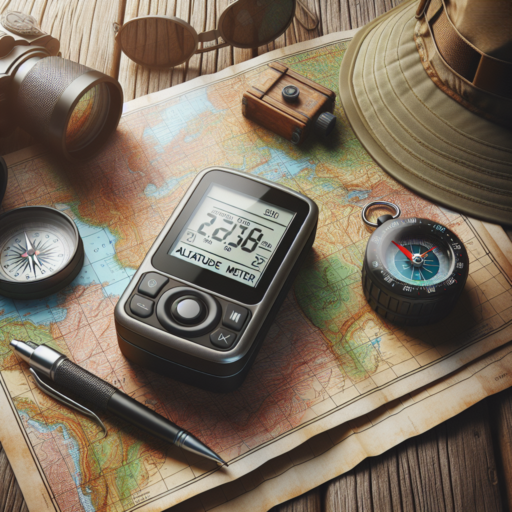
What is a GPS Altitude Meter?
A GPS Altitude Meter, commonly referred to as a GPS altimeter, is a sophisticated device designed to measure an object’s altitude above sea level. Utilizing Global Positioning System (GPS) technology, this meter triangulates data from multiple satellites to calculate precise elevation information. Unlike traditional altimeters that may rely on barometric pressure, GPS Altitude Meters provide altitude readings based on satellite signals, making them widely used in various applications ranging from aviation and hiking to scientific research.
The technology behind GPS Altitude Meters operates by analyzing signals received from a constellation of satellites orbiting the Earth. These satellites transmit signals containing positional data back to the device. By processing this data, the device calculates its position in three-dimensional space, including latitude, longitude, and altitude. This method allows for a high degree of accuracy, often within a few meters, thus making GPS-based altitude measurements invaluable for precise navigational and geological assessments.
One of the key strengths of a GPS Altitude Meter is its utility across diverse environments. Whether it’s being used to navigate through remote wilderness, tracking elevation changes during an outdoor adventure, or aiding in the accurate surveying of land, the versatility of these devices is unmatched. Moreover, advancements in GPS technology continue to enhance the accuracy and reliability of these instruments, broadening their range of applications and making them a staple in many technology-driven tasks.
How Does a GPS Altitude Meter Work?
The functionality of a GPS altitude meter relies predominantly on signals received from a network of satellites that orbit the Earth. This sophisticated piece of technology, integral to various navigation and mapping tools, calculates altitude by intersecting data from multiple satellites to pinpoint its position in three dimensions: latitude, longitude, and elevation.
At the core of a GPS altitude meter’s operation are a minimum of four satellites. Each satellite transmits a signal that includes its location and the precise time the signal was sent. The altitude meter then calculates the distance to each satellite using the time it takes for each signal to reach the receiver. By assessing these distances in conjunction with the known locations of the satellites, the device employs trilateration — a complex mathematical process — to determine its precise three-dimensional position.
However, it’s important to note the distinction in accuracy between geometric altitude and geoid altitude measurements. Geometric altitude refers to the height above the Earth’s surface directly below, while geoid altitude measures height above the Earth’s mean sea level. The GPS altitude meter predominantly provides readings based on geometric altitude, but it can be calibrated to approximate geoid altitude using mathematical models and correction factors.
The Best GPS Altitude Meters for Hiking and Outdoor Adventures
When embarking on hiking and outdoor adventures, the importance of a reliable GPS altitude meter cannot be overstated. These devices are invaluable for navigators and adventurers alike, providing not only elevation details but also ensuring safety and enhancing the overall outdoor experience. With the evolution of technology, there’s an array of options available in the market, each designed to meet the varied needs of the outdoor enthusiast.
Key Features to Consider
When selecting the best GPS altitude meter, several key features stand out as crucial for hikers and outdoor adventurers. Firstly, accuracy is paramount, as even minor discrepancies in elevation can significantly impact navigation and safety. Secondly, durability is essential, given the harsh conditions often encountered outdoors. Devices should be resistant to water, dust, and shocks. Additionally, battery life plays a pivotal role; the ideal GPS altitude meter should offer long hours of service to ensure it remains functional throughout your journey.
Recommended Models for 2023
- Garmin Fenix 6X Pro: Known for its rugged build and precision, this model stands out for its multi-GNSS support and Preloaded TOPO maps, making it a top choice for serious hikers.
- Suunto 9 Baro: With its FusedAlti™ technology, the Suunto 9 Baro provides accurate altitude readings and offers an impressive battery life, tailored for extended adventures.
- Coros Vertix 2: Ideal for extreme adventure enthusiasts, the Vertix 2 offers a global offline map system, ensuring reliable navigation and altitude tracking in even the most remote locations.
Choosing the correct GPS altitude meter is essential for any hiking or outdoor adventure, enhancing both safety and enjoyment. Look for models that balance functionality with durability, ensuring they can withstand the challenges of outdoor environments while providing accurate, reliable data to guide your journey.
Comparing Accuracy: GPS Altitude Meters vs. Barometric Altimeters
When exploring the great outdoors or navigating through unfamiliar territories, understanding your exact altitude can be as crucial as knowing your latitude and longitude. This is where the technology of altitude measurement comes into play, prominently through GPS altitude meters and barometric altimeters. Each has its unique strengths and limitations in terms of accuracy, making a comparison between the two essential for those relying on precise altitude data.
GPS altitude meters utilize a network of satellites to triangulate a user’s position, including height above sea level. This method’s primary advantage is its global coverage, offering altitude data virtually anywhere on the planet. However, the accuracy of GPS altitude can be affected by several factors, including satellite geometry, atmospheric conditions, and the quality of the GPS receiver. Typically, GPS altimeters can exhibit errors of up to 15 meters in vertical measurements under open skies but can significantly increase in urban canyons or dense forests where satellite signals are obstructed.
On the other hand, barometric altimeters measure altitude by calculating the pressure difference between the device’s current location and a pre-defined reference level. Since atmospheric pressure decreases with altitude, this method can provide highly accurate altitude readings, particularly over short timescales. Barometric altimeters are less susceptible to the environmental factors that can affect GPS signals. However, their accuracy can be compromised by sudden changes in weather conditions, requiring regular recalibration against known altitude points for optimal performance.
Step-by-Step Guide to Using a GPS Altitude Meter
Understanding how to accurately utilize a GPS altitude meter is essential for outdoor enthusiasts, hikers, and professionals who rely on precise altitude and location data. This simple guide walks you through the fundamental steps to get the most out of your device, ensuring you can navigate and track elevations with confidence.
1. Turning on Your Device and Initializing GPS
Before embarking on your journey, ensure your GPS altitude meter is fully charged and turn it on. It might take a few minutes for the device to initialize and connect to satellites. Make sure you are in an open area to facilitate this connection. Once the GPS links to satellites, it will start displaying your current location and elevation.
2. Calibrating the Altimeter
For accurate elevation readings, calibration of your GPS altitude meter is crucial. If your device allows, manually calibrate the altimeter using a known altitude or barometric pressure setting. This step is vital, especially before starting a hike or mission, as it ensures the displayed altitude reflects the true elevation. Consult your device’s manual for specific calibration instructions.
3. Using the GPS Altitude Meter During Activities
While on the move, you can use your GPS altitude meter to track elevation gain and loss, monitor the steepness of your ascent or descent, and navigate through unfamiliar terrains. For the best results, keep the device with a clear view of the sky. This practice helps maintain a strong satellite connection, providing continuous and accurate altitude data. Also, regularly checking the elevation readouts aids in orientation and can help prevent straying from your intended path.
GPS Altitude Meter Apps: Transform Your Smartphone into an Altimeter
In the realm of outdoor activities and adventure, having accurate altitude data is indispensable. That’s where GPS Altitude Meter Apps step in, leveraging the power of your smartphone to serve as an effective altimeter. These innovative apps use GPS and other sensory data from your device to calculate your precise altitude above sea level. This functionality is not just beneficial for hikers and mountaineers but also proves invaluable for aviation enthusiasts and geographers seeking to map out terrain features accurately.
One of the greatest advantages of these apps is their accessibility and ease of use. Unlike traditional altimeters, which might require calibration and can be bulky to carry, your smartphone, equipped with a GPS altitude meter app, fits right in your pocket and offers real-time altitude data. This seamless integration into our digital lives makes it easier for everyone to access professional-grade altitude measurements without the need for specialized equipment.
Moreover, many of these apps come with additional features that enhance their utility beyond merely measuring altitude. For instance, they can track your ascent and descent over time, provide temperature and pressure readings, and even overlay your altitude data onto maps for a comprehensive understanding of your environment. This multifaceted approach turns your smartphone into a versatile tool for any expedition, providing critical information at your fingertips.
While the accuracy of GPS Altitude Meter Apps can vary based on factors like device capability and signal strength, ongoing advancements in technology continue to improve their precision and reliability. Developers are constantly updating their algorithms and employing new techniques to ensure that users receive the most accurate altitude readings possible. Therefore, leveraging these apps effectively transforms your smartphone into a powerful and reliable altimeter, indispensable for a wide range of outdoor adventures and scientific applications.
No se han encontrado productos.
How to Calibrate Your GPS Altitude Meter for Maximum Accuracy
Calibrating your GPS altitude meter is essential for ensuring the most accurate readings possible, whether you’re hiking in the mountains or piloting an aircraft. The process involves adjusting your device’s settings and sometimes using external references to correct for any discrepancies in altitude measurement. This task can seem daunting, but with the right approach, you can enhance the reliability of your altitude data significantly.
Understanding the Basics of GPS Altitude Calibration
GPS altitude calibration requires a clear understanding of how your device interprets signals from satellites to estimate your current elevation. This process often involves comparing the device’s internal data with known altitude points or using barometric pressure readings for higher precision. Before attempting calibration, ensure your device’s firmware is up to date to prevent any software-related inaccuracies.
Steps for Effective Calibration
- Step 1: Find a Reference Point – Begin by identifying an elevation point whose exact altitude is known and verifiable. This could be a marked spot on a topographic map or a designated elevation benchmark.
- Step 2: Set Your Device to Calibration Mode – Consult your GPS user manual to locate the calibration feature. This usually involves navigating through the settings menu to a calibration or altitude setting option.
- Step 3: Perform the Calibration – Following your device’s instructions, calibrate your altitude meter using the reference point. This might require you to manually enter the known elevation or to allow the device to adjust itself automatically.
- Step 4: Verify the Calibration – After calibration, compare your device’s altitude reading with the reference point again to ensure the calibration was successful. It’s recommended to do this more than once for greater accuracy.
Regular calibration of your GPS altitude meter, especially before undertaking activities where precision is paramount, can drastically improve the reliability of your altitude data. Keeping these steps in mind, along with continuously updating your understanding of GPS technology, will ensure that you achieve the best possible accuracy from your GPS altitude meter.
Frequently Asked Questions About GPS Altitude Meters
GPS altitude meters have become fundamental tools for everyone from avid hikers to professional pilots, sparking a variety of questions about their functionality and accuracy. Understanding how these devices work and how to interpret their readings can significantly enhance your outdoor adventures or operational tasks.
How Accurate are GPS Altitude Meters?
GPS altitude meters measure height above sea level using signals from satellites. While traditionally considered less accurate than their horizontal counterparts due to the geometry of satellite positioning, advancements in technology have significantly improved their precision. Generally, most handheld units now offer altitude accuracy within +/- 15 meters under open skies. However, factors such as satellite geometry, atmospheric conditions, and the presence of large obstacles can affect accuracy.
Can GPS Altitude be Calibrated for Better Accuracy?
Yes, calibrating your GPS altitude meter can enhance its accuracy. This process involves comparing the GPS reading with a known elevation reference point, such as a survey marker or altitude readings on topographic maps. Many devices auto-calibrate by locking onto a set of satellites while stationary, but manual calibration may yield even better results, especially in areas with significant elevation changes.
Why Does My GPS Show Different Altitude Readings for the Same Location?
It’s not uncommon for GPS altitude meters to display varying readings for the same location due to several factors. The number of satellites in view, atmospheric conditions, and even changes in local geography over time can all influence the readings. The device’s ability to accurately triangulate your position relative to the satellites it’s connecting with also plays a significant role. For the most consistent results, ensure your device has a clear view of the sky and is calibrated regularly.
The Future of Altitude Measurement: Innovations in GPS Technology
The evolution of altitude measurement has been significantly impacted by advancements in GPS technology. In the past, measuring elevation required complex and often cumbersome tools, but today’s GPS devices provide accurate and efficient altitude readings. This development has been a game-changer for various sectors including aviation, hiking, and even smartphone applications designed for fitness and outdoor activities.
Enhanced Accuracy in Difficult Environments
One of the remarkable innovations in GPS technology regarding altitude measurement is its enhanced accuracy, even in challenging environments. Traditional GPS systems struggled in areas with dense foliage or urban settings with tall buildings. However, modern GPS systems incorporate advanced algorithms and satellite data fusion to offer more precise altitude information. This improvement is crucial for applications requiring pinpoint accuracy, such as geological surveys and environmental research.
Real-Time Altitude Adjustments
Another significant advancement is the capability for real-time altitude adjustments. Previous GPS models required considerable time to recalibrate and provide accurate elevation data. Current innovations now enable these devices to adjust to new altitudes instantly, benefiting activities that involve rapid altitude changes, such as mountaineering or skiing. This instant data adjustment ensures safety and enhances user experience by providing timely and accurate altitude information.
Top Tips for Maintienance and Care of Your GPS Altitude Meter
Maintaining your GPS altitude meter is essential for ensuring its accuracy and longevity. These precision instruments, vital for outdoor enthusiasts, hikers, and professionals alike, require regular care. By adopting some straightforward maintenance routines, you can prevent common issues and keep your device in top working condition. Here are several top tips to help you preserve the functionality and reliability of your GPS altitude meter.
Regular Cleaning and Inspection
First and foremost, regular cleaning and inspection play a crucial role in the maintenance of your GPS altitude meter. Dirt, dust, and moisture can affect the device’s performance. Use a soft, dry cloth to gently clean the exterior and screen, avoiding harsh chemicals that may damage the screen or casing. Additionally, inspect your device for any signs of wear or damage, especially after extensive field use. Pay special attention to the battery compartment, ensuring it’s free of corrosion and moisture, which can lead to power issues.
Software and Firmware Updates
Keeping your device’s software and firmware up to date is another essential step. Manufacturers often release updates that improve performance, add new features, or resolve known issues. Regularly check the manufacturer’s website or connect your device to its companion software to download and install the latest updates. This not only enhances the functionality of your GPS altitude meter but can also extend its useful life by ensuring compatibility with newer technologies and standards.
• Regularly clear the device of dirt and dust using a soft, dry cloth.
• Inspect for physical damage, especially in the battery compartment, to avoid power problems.
• Keep the software and firmware updated to enhance performance and extend the device’s lifespan.