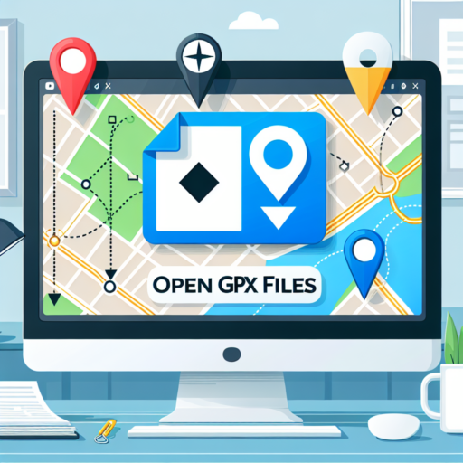
What program opens GPX files?
GPX files, standing for GPS Exchange Format, are XML files designed to store and exchange GPS data like routes, tracks, and waypoints between programs and web services. This format is widely used by various outdoor and fitness apps to share location-based information. Knowing the right software to open GPX files is crucial for adventurers, sports enthusiasts, and anyone looking to work with geographic data.
Several programs are capable of handling GPX files effectively. The most popular among them is Google Earth, which lets users import GPX files directly to view their GPS data in a comprehensive 3D mapping interface. Besides Google Earth, Garmin BaseCamp is another program specifically designed for managing Garmin GPS device data, including viewing and organizing GPX files. For those who prefer working within a desktop environment, GPXSee is a universally acclaimed desktop application available across multiple platforms, offering a detailed analysis of GPX data without the need for internet connectivity.
Alongside these dedicated applications, several online tools offer the convenience of viewing GPX files without the need to download any software. Websites like GPS Visualizer and Strava not only allow users to open and view GPX files but also provide in-depth analysis and sharing capabilities, making them ideal for social fitness enthusiasts who wish to share their activities with a community.
No se han encontrado productos.
Can I open a GPX file in Google Maps?
Opening a GPX file in Google Maps directly might not be straightforward, but it is indeed possible with a few workaround steps. GPX, which stands for GPS Exchange Format, is commonly used for sharing GPS data like routes, waypoints, and tracks. While Google Maps primarily operates with its own mapping data, importing a GPX file requires converting it into a format compatible with Google’s services.
Conversion Process
To make your GPX file readable by Google Maps, you first need to convert it to a KML (Keyhole Markup Language) file. Numerous online tools and software are available for this purpose, offering a simple upload-and-convert functionality. Once your GPX file is converted to KML, you can easily import it into Google Maps using the «My Maps» feature, allowing you to view your routes or waypoints right on Google Maps.
Using Third-party Services
Another approach involves using third-party services and websites that act as intermediaries to display your GPX files on Google Maps without the need for conversion. These platforms typically require you to upload your GPX file, after which they overlay the contained GPS data onto Google Maps, providing you with a unique link to view and share your map. This method is especially convenient for those seeking a quick and effortless way to visualize their GPQ file’s data on Google Maps.
How to view GPX files for free?
Viewing GPX files doesn’t have to come with a hefty price tag. Many free solutions exist that allow outdoor enthusiasts, athletes, and travelers to explore geographic data with ease. Whether it’s plotting your next hike, reviewing your cycling route, or sharing your latest adventure, free tools make GPX file viewing accessible to all.
Online GPX Viewers
One of the simplest ways to view GPX files for free is through online GPX viewers. Websites like GPS Visualizer and My GPS Files allow users to upload their GPX files directly from their computers or smartphones and see their routes displayed on maps. These platforms often provide additional tools, such as elevation profile views and the ability to share your routes on social media.
Desktop Software
For those who prefer viewing their data offline, free desktop software provides an in-depth look at GPX files without an internet connection. Applications like GPXSee and BaseCamp by Garmin offer comprehensive analysis tools, including detailed maps, elevation graphs, and extensive data about your tracks and waypoints. By downloading one of these applications, users gain a more nuanced understanding of their outdoor activities.
- Utilize online GPX viewers for quick and easy access.
- Explore free desktop software for a more detailed analysis.
Can I open GPX files in Google Earth?
Yes, GPX files can be opened in Google Earth, offering users an intuitive way to visualize their GPS data on a highly detailed, interactive map. The process is straightforward, allowing both beginners and experts to benefit from the capabilities of Google Earth when analyzing and sharing their geographical information.
The process involves converting the GPX file to a format that is compatible with Google Earth, typically a KML (Keyhole Markup Language) file. Various online tools and software options offer this conversion service for free. Once converted, these files can be easily imported into Google Earth, giving users a comprehensive view of their waypoints, routes, and tracks in the context of real-world terrain and imagery.
To enhance the viewing experience, Google Earth allows users to customize how their GPX data is displayed. This includes adjusting the style and color of paths, adding markers or waypoints, and even integrating photos and descriptions for a more informative and personalized visualization. By taking advantage of these features, users can create compelling presentations of their journeys, hikes, or other GPS-tracked activities.